


SPEARFISH CREEK FLOODPLAIN ANALYSIS
Spearfish, South Dakota
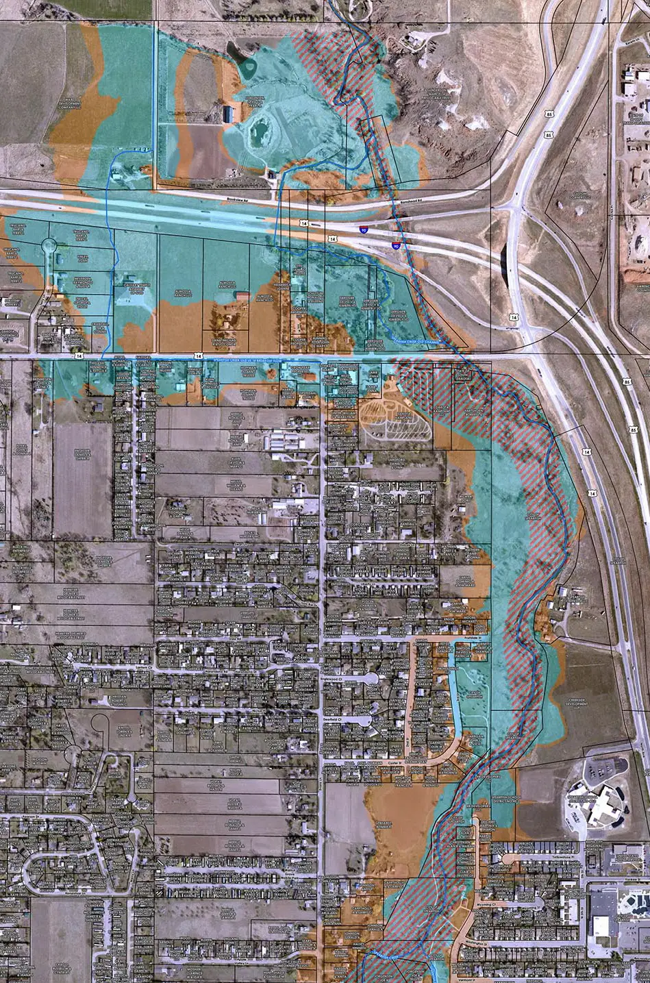
About the Project
Spearfish Creek is the main stream flowing through the City of Spearfish (City) and was included in the City’s original 1981 Flood Insurance Rate Maps (FIRMs). As the city expanded north, revised floodplain mapping in 1990 extended north past Interstate 90. As with many communities that were mapped in the 1980s and 1990s, issues between the mapping and physical reality were prevalent. In the case of Spearfish, the floodway was mapped several hundred feet away from where the actual creek was. Further, hydraulic modeling and mapping between Old US 14 and Interstate 90 was both crude and incorrect.
Mapping the Channels
Because the north side of Spearfish is one of the expanding areas of the City, AE2S was retained by the City to revise the floodplain and floodway mapping for a section of Spearfish Creek. In addition to the main channel, several breakout flow channels in the project reach had to be analyzed and mapped in order to create accurate Base Flood Elevations that would aid the City in floodplain zoning and management. In total, the floodplain remapping project included:
- 1.5 miles of Spearfish Creek,
- 0.6 miles of the Spearfish Creek Old Channel,
- 0.8 miles of the Spearfish Creek Old US 14 Breakout Channel, and
- 700 feet of the Spearfish Creek Breakout Channel
Completed the Project in an Accelerated Timeframe
Because of the inaccurate FEMA mapping, several development projects were put on hold pending the revised mapping, so completing the project on an accelerated time frame was critical to allow development to continue while still providing the necessary flood zoning and protection for new development. AE2S completed draft floodplain mapping for presentation to City staff in less than two months, despite the complexities that existed on this project with the numerous breakout flow routes.
Project Details
Date: 2015 – Present
Client: City of Spearfish
Key Project Elements
- LOMR Submittal
- FEMA Region 8
- Flood Risk Reduction Improvements