


SIOUX FALLS BIG SIOUX RIVER BANK STABILIZATION
Sioux Falls, South Dakota
About the Project
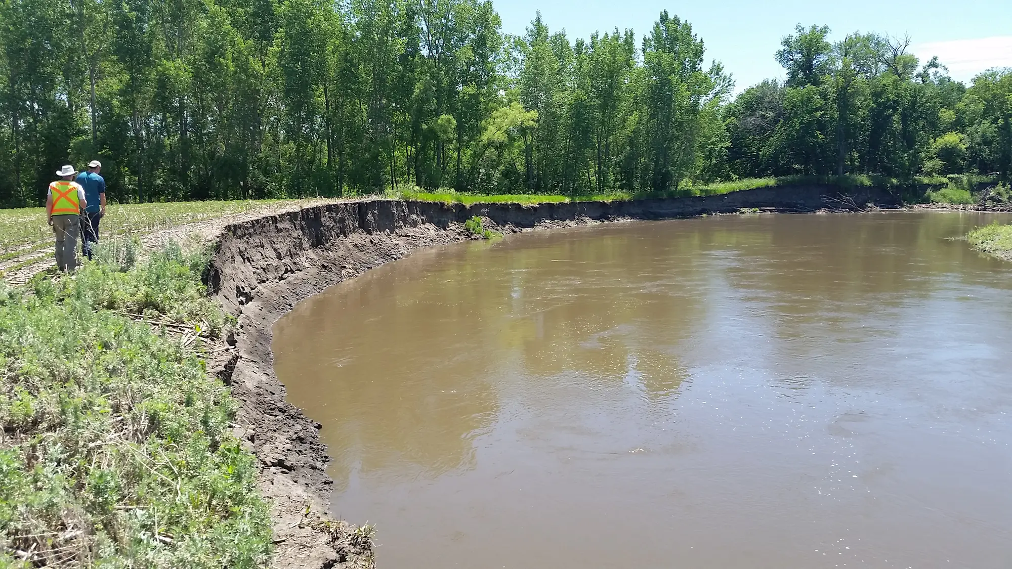
AE2S was a key part of a multi-firm team that completed a geomorphic assessment of the Big Sioux River north of Sioux Falls to determine bank erosion rates and potential for future channel migration. The design of bank stabilization measures along the river also included evaluating the scour potential of the channel bottom to ensure that the toe of the bank protection measures was stable during a flood event. Following up on the geomorphic assessment, ten sites were identified as high priorities for bank stabilization measures. AE2S was the lead designer on seven of the ten sites and took the lead on Federal Section 404 permitting based on our extensive experience working with the USACE. All seven sites included riprap stabilization, given the high potential for significant erosion potential, steep banks, and need to limit impacts to the adjacent landowners. The project also included extensive coordination and meetings with the Corps of Engineers regulatory division, given their concern of the potential long-term impacts of the project and that several sites were involved in re-design of previous attempts at bank stabilization.
Project Details
Date: 2017 – 2018
Client: City of Sioux Falls
Key Project Elements
- Hydrologic and Hydraulic Studies
- Geomorphic Assessment
- Alternative Development
- Water Surface Profile Modeling
- Public Outreach
- Federal/State/Local Permitting